En
Log in
All resources
Create a design
Tools
7,118 Free Images of Engraved Maps
british library
copper engraving print
joan blaeu
maps from the earth and its inhabitants, vol. iv
vrbivm praecipvarvm totivs mvndi (1612)
national library of poland
atlas maior, vol 3 (germany) - joan blaeu, 1667 - bl 114.h(star).3
maps from the earth and its inhabitants, vol. v
maps from the earth and its inhabitants, vol. xviii
maps from the earth and its inhabitants, vol. xii
maps from the earth and its inhabitants, vol. v
19th-century maps of copenhagen
maps from the earth and its inhabitants, vol. iv
maps of the north atlantic
maps from the earth and its inhabitants, vol. xiv
maps of hawaii island
maps from the earth and its inhabitants, vol. v
19th-century maps of saint petersburg
maps from the earth and its inhabitants, vol. iv
old maps of norwich
maps from the earth and its inhabitants, vol. xviii
maps of agriculture in colombia
maps from the earth and its inhabitants, vol. xvi
maps of weather and climate of mexico
maps from the earth and its inhabitants, vol. xv
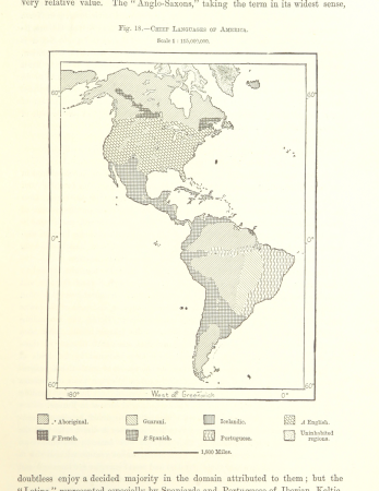
linguistic maps of the americas
maps from the earth and its inhabitants, vol. iv
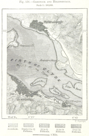
maps of the firth of clyde
maps from the earth and its inhabitants, vol. viii
old maps of mumbai
maps from the earth and its inhabitants, vol. iv
old maps of glasgow
maps from the earth and its inhabitants, vol. xi
1870s maps of morocco
maps from the earth and its inhabitants, vol. xviii
old maps of bogotá
maps from the earth and its inhabitants, vol. iv
old maps of derby
maps from the earth and its inhabitants, vol. v
19th-century maps of stockholm
maps from the earth and its inhabitants, vol. v
19th-century maps of saint petersburg
maps from the earth and its inhabitants, vol. xi
1870s maps of algeria
maps from the earth and its inhabitants, vol. xii
old maps of cameroon
maps from the earth and its inhabitants, vol. iv
old maps of aberdeen
maps from the earth and its inhabitants, vol. xii
old maps of the canary islands
maps from the earth and its inhabitants, vol. x
religion maps of africa
maps from the earth and its inhabitants, vol. iv
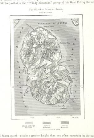
old maps of the isle of arran
maps from the earth and its inhabitants, vol. xviii
old maps of curaçao
maps from the earth and its inhabitants, vol. xi
old maps of algeria
maps from the earth and its inhabitants, vol. xvii
maps of the tennessee river
maps from the earth and its inhabitants, vol. iv
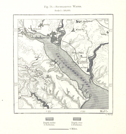
old maps of southampton
maps from the earth and its inhabitants, vol. xii
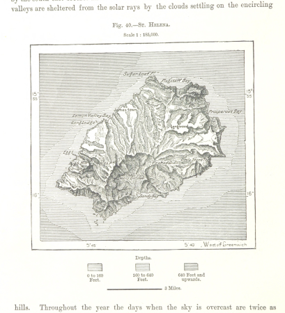
old maps of saint helena
maps from the earth and its inhabitants, vol. xiii
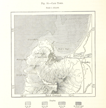
old maps of cape town
maps from the earth and its inhabitants, vol. xvii
19th-century maps of san francisco
maps from the earth and its inhabitants, vol. x
maps of weather and climate of africa
maps from the earth and its inhabitants, vol. xvi
archaeological maps of mexico
maps from the earth and its inhabitants, vol. xv
maps of ocean currents
maps from the earth and its inhabitants, vol. xii
old maps of tenerife
maps from the earth and its inhabitants, vol. iv
old maps of portsmouth
maps from the earth and its inhabitants, vol. xviii
maps of weather and climate of south america
maps from the earth and its inhabitants, vol. iv
old maps of the shetland islands
maps from the earth and its inhabitants, vol. xviii
old maps of bogotá
maps from the earth and its inhabitants, vol. xvi
19th-century maps of guadeloupe
maps from the earth and its inhabitants, vol. viii
topographic maps of sri lanka
maps from the earth and its inhabitants, vol. iv
maps of st kilda
maps from the earth and its inhabitants, vol. iii
population density maps of europe
maps from the earth and its inhabitants, vol. xiv
maps of voyages
maps from the earth and its inhabitants, vol. xii
sokoto
maps from the earth and its inhabitants, vol. v
nyoe
atlas maior, vol 3 (germany) - joan blaeu, 1667 - bl 114.h(star).3
copper engraving print
atlas maior, vol 4 (netherlands) - joan blaeu, 1667 - bl 114.h(star).4
copper engraving print
atlas maior, vol 4 (netherlands) - joan blaeu, 1667 - bl 114.h(star).4
copper engraving print
atlas maior, vol 3 (germany) - joan blaeu, 1667 - bl 114.h(star).3
copper engraving print
atlas maior, vol 3 (germany) - joan blaeu, 1667 - bl 114.h(star).3
copper engraving print
atlas maior, vol 3 (germany) - joan blaeu, 1667 - bl 114.h(star).3
copper engraving print
atlas maior, vol 3 (germany) - joan blaeu, 1667 - bl 114.h(star).3
copper engraving print
atlas maior, vol 3 (germany) - joan blaeu, 1667 - bl 114.h(star).3
copper engraving print
atlas maior, vol 3 (germany) - joan blaeu, 1667 - bl 114.h(star).3
17th-century maps of silesia
atlas maior, vol 2 (sweden, russia, poland, eastern europe, and greece) - joan blaeu, 1667 - bl 114.h(star).2
maps of slavonia by gerardus mercator
atlas maior, vol 1 (northern europe, norway, and denmark) - joan blaeu, 1667 - bl 114.h(star).1
1667 maps
atlas maior, vol 2 (sweden, russia, poland, eastern europe, and greece) - joan blaeu, 1667 - bl 114.h(star).2
1667 maps of russia
maps from the earth and its inhabitants, vol. xvii
natchez
parts of old maps of bremen
baroque
atlas maior, vol 2 (sweden, russia, poland, eastern europe, and greece) - joan blaeu, 1667 - bl 114.h(star).2
copper engraving print
atlas maior, vol 1 (northern europe, norway, and denmark) - joan blaeu, 1667 - bl 114.h(star).1
1667 maps
atlas maior, vol 2 (sweden, russia, poland, eastern europe, and greece) - joan blaeu, 1667 - bl 114.h(star).2
17th-century maps of the aegean sea
atlas maior, vol 2 (sweden, russia, poland, eastern europe, and greece) - joan blaeu, 1667 - bl 114.h(star).2
1667 maps of russia
matthias diesel
1717 engravings
david rumsey historical map collection
1790s maps of the holy roman empire
vrbivm praecipvarvm totivs mvndi (1612)
maps of husum by braun & hogenberg
vrbivm praecipvarvm totivs mvndi (1612)
maps of oberwesel by braun & hogenberg
vrbivm praecipvarvm totivs mvndi (1612)
maps of krempe by braun & hogenberg
vrbivm praecipvarvm totivs mvndi (1612)
maps of flensburg by braun & hogenberg
vrbivm praecipvarvm totivs mvndi (1612)
maps of marchena by braun & hogenberg
old maps of île saint-louis
maps of paris in the 1740s
atlas maior, vol 4 (netherlands) - joan blaeu, 1667 - bl 114.h(star).4
1667 maps
vrbivm praecipvarvm totivs mvndi (1612)
maps of lippstadt by braun & hogenberg
engravings of topographia braunschweig lüneburg
baroque
maps by girolamo ruscelli
maps by girolamo porro
maps of budapest by braun & hogenberg
16th-century fortress plans
vrbivm praecipvarvm totivs mvndi (1612)
maps of lauingen by braun & hogenberg
maps of chalon-sur-saône by braun & hogenberg
vrbivm praecipvarvm totivs mvndi (1612)
vrbivm praecipvarvm totivs mvndi (1612)
maps of eisleben by braun & hogenberg
maps of arnsberg by braun & hogenberg
history of arnsberg
maps by alexis-hubert jaillot
old maps of toulouse
eran laor cartographic collection
edward weller
eran laor cartographic collection
édouard hocquart
maps by louis brion de la tour
18th-century maps of tartary
old maps of north holland
zaandam
engravings by matthäus merian
baroque
engravings of topographia austriacarum
baroque
old maps of zeeland
copper engravings
1750s maps of north america
solomon bolton
1740s maps of the united kingdom
maps in the british museum
eran laor cartographic collection
pierre françois tardieu
maps by nicolaes visscher i
maps by daniel stoopendaal
naval battles involving the ottoman empire in art
bombardment of algiers (1783)
maps by jakob van der schley
old maps of southeast asia
18th-century maps of istanbul
1771 maps of turkey
maps by alexis-hubert jaillot
old maps of the tyrol
media from accademia delle scienze di torino
1574 engravings
romanticism,neoclassicism
1852 maps of france
maps by richard william seale
1740s maps of south america
old maps of rennes
adolphe périaux
eran laor cartographic collection
james mynde (engraver)
2401 - 2500 of 7,118
Next page
/ 72